Castle Island
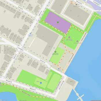
Castle Island Map
About Castle Island in Boston
Castle Island, located in South Boston, Massachusetts, is a 22-acre urban park connected to the mainland by a narrow strip of land. This historic site offers visitors a unique blend of natural beauty, recreational opportunities, and rich American history.
The focal point of Castle Island is Fort Independence, a pentagonal five-bastioned granite fort built between 1834 and 1851. This impressive structure, listed on the National Register of Historic Places, represents the eighth generation of forts on the island, with fortifications dating back to 1634. During summer months, visitors can take guided tours of the fort to explore its fascinating history.
Castle Island provides scenic views of Boston Harbor and Logan Airport, making it a popular spot for locals and tourists alike. The park features a 2.2-mile paved walkway called Harborwalk, which circles Pleasure Bay and offers opportunities for walking, jogging, and cycling. This path is part of the larger Boston Harborwalk that spans much of the city's waterfront.
For those seeking outdoor recreation, Castle Island offers several beaches along its shoreline, including Pleasure Bay Beach and a portion of Carson Beach. These areas provide space for sunbathing, swimming, and fishing. A dedicated fishing pier on the harbor side of the fort is available for anglers.
Families with children can enjoy the playground area, which is modeled after the fort's five-point star-shaped plan. Picnic areas with tables and grills are scattered throughout the park, offering visitors the chance to relax and enjoy meals outdoors.
The park is open year-round from dawn to dusk, allowing visitors to experience its beauty across all seasons. While parking is available, it can fill up quickly on weekends and during peak summer months.


