High Bridge Park
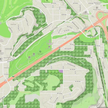
High Bridge Park Map
About High Bridge Park in Spokane
High Bridge Park is a 200-acre public park located in the Latah/Hangman area of Spokane, Washington, near Riverside Avenue and A Street. The park is open daily without charge, providing residents and visitors with a spacious natural retreat within the city limits.
The park stretches along the lower reaches of Latah Creek, extending to its confluence with the Spokane River. Much of High Bridge Park's terrain consists of steep hillsides that descend to the river and creek, with elevations ranging from approximately 1,900 feet above sea level to 1,720 feet where Latah Creek meets the Spokane River.
High Bridge Park's landscape is diverse, featuring both developed and undeveloped areas. Of its 200 acres, 137 remain undeveloped, preserving natural habitats and offering opportunities for wildlife observation. The park's unique geography allows it to span multiple neighborhoods, including Latah/Hangman, Browne's Addition, Peaceful Valley, West Central, and West Hills.
The park has undergone several improvements since the early 21st century. In 2004, the Sandifur Memorial Bridge was completed, connecting People's Park to the north bank of the river and linking various trails and bike routes. The park's disc golf course was also constructed around this time. In 2011, High Bridge Dog Park was established as the city's first dedicated dog park.
Recent developments include the 2020 refurbishment of the People's Park parking lot, which now features public art and informative signage. In 2021, plans were approved to connect the Fish Lake Trail with the Centennial Trail through the park. Additionally, in 2023, the city gave approval for the American Indian Community Center to construct a facility on two undeveloped acres within the park.