Earthquake Park
Earthquake Park Map
About Earthquake Park in Anchorage
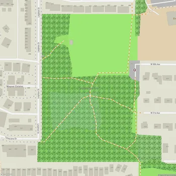
Earthquake Park is a 134-acre public park located in Anchorage, Alaska that commemorates the devastating 1964 Alaska earthquake. The park sits on the site of a neighborhood that was destroyed when the ground gave way during the 9.2 magnitude quake, which remains the most powerful earthquake recorded in North American history.
The park features interpretive displays that explain the geological forces at work during the earthquake and provide information about Anchorage's history before and after the disaster. Visitors can see evidence of the earthquake's power in the park's landscape, including a sharp drop-off to the north and unusual rippling hills formed by the shifting ground.
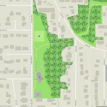
An interpretive walking trail accessible from the parking lot allows visitors to observe telltale signs of the altered landscape up close. The trail forms a loop and is also part of the longer Tony Knowles Coastal Trail that runs through the park. From various points in Earthquake Park, visitors can take in scenic views of the Knik Arm waterway and the Chugach Mountains.
The wooded park provides habitat for local wildlife, including moose that can sometimes be spotted among the trees. While primarily focused on education about the 1964 earthquake, Earthquake Park also serves as a place for outdoor recreation and appreciation of Anchorage's natural surroundings.