Boulder Mountain Park
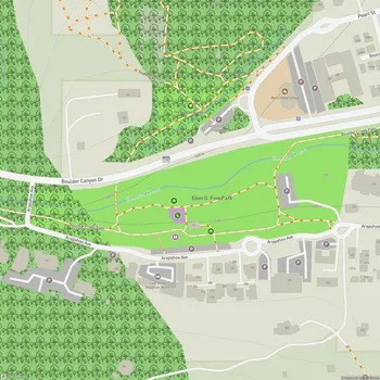
Boulder Mountain Park Map
About Boulder Mountain Park in Boulder
Boulder Mountain Park is a vast protected area encompassing over 45,000 acres of rugged land surrounding the city of Boulder, Colorado. Established through a series of land acquisitions beginning in the late 19th century, the park serves multiple purposes: preserving natural areas, preventing urban sprawl, and framing Boulder's iconic mountainous backdrop.
The park is home to 18 named mountains, with South Boulder Peak being the highest and most prominent. The landscape is characterized by diverse ecosystems, including ponderosa pine forests, rocky outcrops, and open meadows. This variety of habitats supports a rich array of wildlife and plant species, including some threatened and endangered species.
Boulder Mountain Park offers approximately 155 miles of trails, providing extensive recreational opportunities for hikers, runners, and mountain bikers. The trail system ranges from easy, accessible paths to challenging routes that ascend the park's peaks. Many of these trails offer spectacular views of Boulder Valley, the surrounding mountains, and even distant vistas of the Great Plains.
The park's most recognizable features are the Flatirons, a series of striking, slanted, reddish-brown sandstone formations that form part of Boulder's western skyline. These distinctive rock formations are popular among rock climbers and offer a dramatic backdrop for many of the park's trails.
Boulder Mountain Park plays a crucial role in the city's environmental conservation efforts. It serves as a buffer zone between urban development and natural areas, helps protect water resources, and preserves important wildlife corridors. The park also contributes to Boulder's commitment to sustainability and outdoor recreation, making it an integral part of the city's identity and quality of life.