The Strand
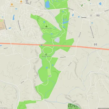
The Strand Map
About The Strand in Louisville
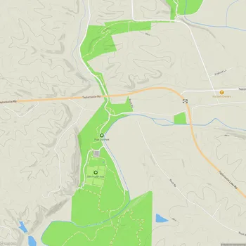
The Strand is a significant section of The Parklands of Floyds Fork in Louisville, Kentucky. Spanning 404.9 acres, it serves as the central connecting piece between the northern and southern parts of The Parklands. The park offers a serene environment for various outdoor activities, including walking, running, and cycling.
The Strand features over five miles of the Louisville Loop, a paved multi-use trail that winds through the park, crossing bridges and meandering along neighboring agricultural fields. Visitors can experience diverse landscapes within The Strand, including areas known as The Palisades, Walnut Grove, and Mussel Bend.
The park's natural beauty is evident in its mosaics of fossils and shadowy undergrowth that extend down to Floyds Fork, where visitors can find a canoe launch and fishing spots. The Strand's landscape provides a picturesque setting for outdoor enthusiasts, with scenic trails and multiple bike paths set against a backdrop of natural beauty.
For those looking to explore The Strand, the Strand Trailhead serves as an excellent starting point. Located approximately midway through the park, it offers essential facilities for visitors embarking on their outdoor adventures.