Burncoat Park
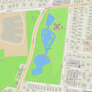
Burncoat Park Map
About Burncoat Park in Worcester
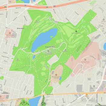
Burncoat Park, formerly known as North Park, is a 26-acre public green space located in Worcester, Massachusetts. Situated just north of I-290 and Brittan Square, the park offers a diverse landscape with significant elevation changes, providing visitors with varied experiences and views.
The park features two natural ponds, which serve as focal points for visitors throughout the year. During warmer months, these ponds offer scenic spots for walkers to enjoy, while in winter, one of the ponds transforms into an ice skating rink, continuing a tradition that began in 1923.
Burncoat Park's topography is notable for its varying elevation, with a 47-foot change in grade within the park. The highest point, located along Davidson Road on the north edge, is popular as a sledding hill during winter months and offers excellent views of the surrounding area.
The park has a rich history dating back to 1889 when the initial 39.42 acres were purchased from multiple landowners. Over the years, various additions and changes have shaped the park, including the creation of Western Pond in 1898 and the construction of the Boulder Bridge in 1901. In 1962, a portion of the park was taken by the Commonwealth of Massachusetts for the construction of the I-290 expressway.
Burncoat Park serves as a versatile recreational space for the community, offering opportunities for various activities throughout the year, from nature walks and picnics to seasonal sports and winter recreation.