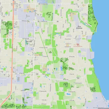
Grant Park
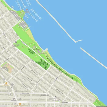
Grant Park Map
About Grant Park in Milwaukee
Grant Park is a 381-acre public park located in South Milwaukee, Wisconsin, along the shore of Lake Michigan. Established in 1910, it is one of the oldest and second-largest parks in the Milwaukee County Parks system.
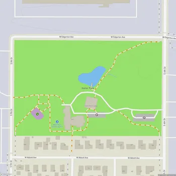
The park features a diverse landscape, including towering lakeshore bluffs, deep ravines, sandy beaches, and wooded areas. It is home to the Seven Bridges Trail, a popular 2-mile hiking loop that winds through ravines and over several wooden footbridges, including a distinctive covered Bavarian-style bridge at the trail entrance.
Grant Park's natural areas support a variety of flora and fauna. The ravines are heavily wooded with old-growth stands of American Beech, Maple, White Ash, and Yellow Birch trees. The forest floor hosts numerous spring ephemeral wildflowers, while the bluffs adjacent to the trail contain a wet fen supporting rare plant species. The park's position along Lake Michigan makes it an important stopover for migratory birds.
The park offers extensive recreational opportunities. It contains Milwaukee County's first 18-hole golf course, which opened in 1920 and still uses a historic 1892 farmhouse as its clubhouse. The beach area provides access to Lake Michigan for swimming and includes volleyball courts. A paved section of the Oak Leaf Trail, a multi-use path system, runs through the park.
Grant Park has played a significant role in local history. During the Great Depression, hundreds of workers from the Works Progress Administration (WPA) and Civilian Conservation Corps (CCC) contributed to the development of the park's infrastructure, including trails, bridges, and stone structures.
Today, Grant Park serves as a popular destination for outdoor enthusiasts, families, and nature lovers, offering a blend of recreational facilities and natural beauty just minutes from urban areas.