Fruitvale Bridge Park
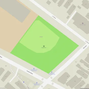
Fruitvale Bridge Park Map
About Fruitvale Bridge Park in Oakland
Fruitvale Bridge Park is a small urban park located in Oakland, California. The park covers an area of approximately 0.33 acres (1,300 square meters). It is positioned at the eastern end of the Fruitvale Bridge, which spans the Oakland Estuary connecting Oakland to the city of Alameda.
The park serves as a gateway to the Fruitvale neighborhood and marks the endpoint of Sausal Creek, which flows underground at this location before draining into the estuary. Despite its limited size, Fruitvale Bridge Park offers visitors a vantage point to observe the Oakland Estuary and the surrounding urban landscape.
Historically, the park included a fishing pier that extended into the estuary, providing anglers with opportunities to catch various fish species. However, as of 2018, the pier has been closed due to safety concerns and is no longer accessible to the public.
The park's location near the busy Fruitvale Bridge and across from the former Owens-Illinois Glass Factory means it may not offer the most tranquil environment. Nevertheless, it provides a small green space in an otherwise heavily urbanized area.
It's worth noting that the park has faced challenges in recent years, including issues related to homelessness and maintenance. As part of ongoing efforts to improve the area, there are plans to incorporate Fruitvale Bridge Park into a larger project called Fruitvale Alive!, which aims to enhance pedestrian and bicycle safety along Fruitvale Avenue.