Panhandle
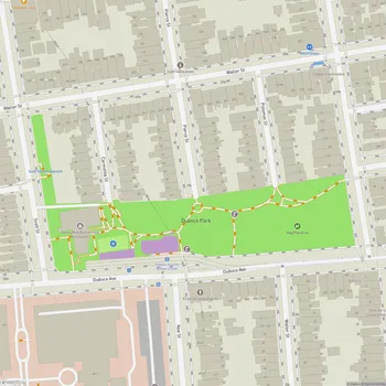
Panhandle Map
About Panhandle in San Francisco
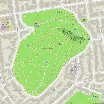
The Panhandle is a unique public park in San Francisco, California, stretching three-quarters of a mile long and one block wide. It serves as a narrow extension of Golden Gate Park, connecting it to the eastern neighborhoods of the city. The park's distinctive shape, resembling a pan's handle, gives it its name.
Originally designed in the 1870s, the Panhandle was initially used as an experimental arboretum by William Hammond Hall, the first state engineer of California. It played a crucial role in transforming the area from windswept sand dunes into a lush, green space. Today, the park boasts some of the oldest trees in the Golden Gate Park complex, including various species from around the world such as eucalyptus, elm, and cypress.
The Panhandle features paved walking and biking paths that run the length of the park, making it a popular route for commuters and recreational users alike. The park's central location between the Haight-Ashbury and Western Addition neighborhoods has made it a significant community space throughout San Francisco's history.
In the 1960s, the Panhandle was at the center of community activism when plans to convert it into a freeway were successfully opposed by local residents. This preserved the park as a valuable green space in the urban landscape. In recent years, the park has undergone renovations, including updates to its playground and the addition of outdoor exercise equipment.
The Panhandle serves multiple functions for the community, offering a space for relaxation, exercise, and community gatherings. Its long, narrow layout provides a unique urban park experience, distinct from the more expansive Golden Gate Park to which it connects.