Portage Lakes State Park
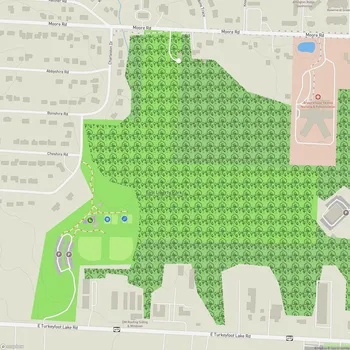
Portage Lakes State Park Map
About Portage Lakes State Park in Akron
Portage Lakes State Park is a 411-acre public recreation area located near Akron, Ohio. The park surrounds a series of eight connected lakes that span over 2,000 acres of water. These lakes were originally created as feeder reservoirs for the Ohio and Erie Canal system in the 19th century.
The park offers visitors a variety of outdoor recreational opportunities centered around its extensive water resources. Boating is very popular, with eight boat launch ramps providing access to the lakes. All lakes have a 400 horsepower limit, except for Nimisila Reservoir which only allows electric motors. Water skiing, jet skiing, and sailing are common activities on the larger lakes.
Fishing is another major draw, with anglers pursuing species like largemouth bass, bluegill, crappie, and channel catfish. The park has several fishing piers and shoreline access points. Swimming is available at a 900-foot public beach on Turkeyfoot Lake.
On land, the park has several miles of hiking trails that wind through woodlands and wetland areas. These natural habitats attract diverse wildlife, especially waterfowl and shorebirds. Visitors can observe species like great blue herons, Canada geese, and various duck species. The forested areas are home to white-tailed deer, raccoons, and other mammals.
Picnicking facilities are available at multiple locations around the lakes, with shelters that can be reserved. In winter, when conditions allow, visitors can enjoy activities like ice fishing, ice skating, and cross-country skiing.
The park's unique name comes from its location on an ancient Native American portage route between the Cuyahoga and Tuscarawas river systems. This eight-mile overland connection allowed travel between Lake Erie and the Ohio River with only a short portage required.