Duncan Neighborhood Park
Duncan Neighborhood Park Map
About Duncan Neighborhood Park in Austin
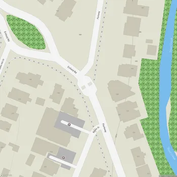
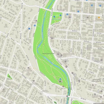
Duncan Neighborhood Park is located in the heart of Austin, Texas, situated along Shoal Creek at the intersection of West 9th Street and North Lamar Boulevard. This urban green space spans approximately one city block, offering a serene retreat within the bustling downtown area.
The park is characterized by its riparian habitat, which provides a natural buffer along Shoal Creek. Visitors can enjoy panoramic views of the Austin skyline from various vantage points within the park, making it a popular spot for both relaxation and photography. A nature trail winds through the area, allowing park-goers to explore the local flora and fauna.
In recent years, Duncan Neighborhood Park has undergone significant improvements to enhance its functionality and ecological value. The park now features a wetland area with an overlook, designed to improve water quality and provide educational opportunities about local ecosystems. Native wildflower meadows have been established to support biodiversity and create seasonal visual interest.
Accessibility has been a key focus of recent upgrades, with the addition of an ADA-compliant path connecting 9th and 10th Streets. The park also boasts enhanced connections to the larger Shoal Creek Hike and Bike Trail system, integrating it into Austin's broader network of green spaces.
For over 75 years, Duncan Neighborhood Park has served the local community, evolving to meet changing needs while maintaining its natural character. The park's improvements, funded by municipal bonds, reflect a commitment to preserving urban green spaces and enhancing their ecological and recreational value for Austin residents and visitors alike.